THE REGION
A territory that unites us all!
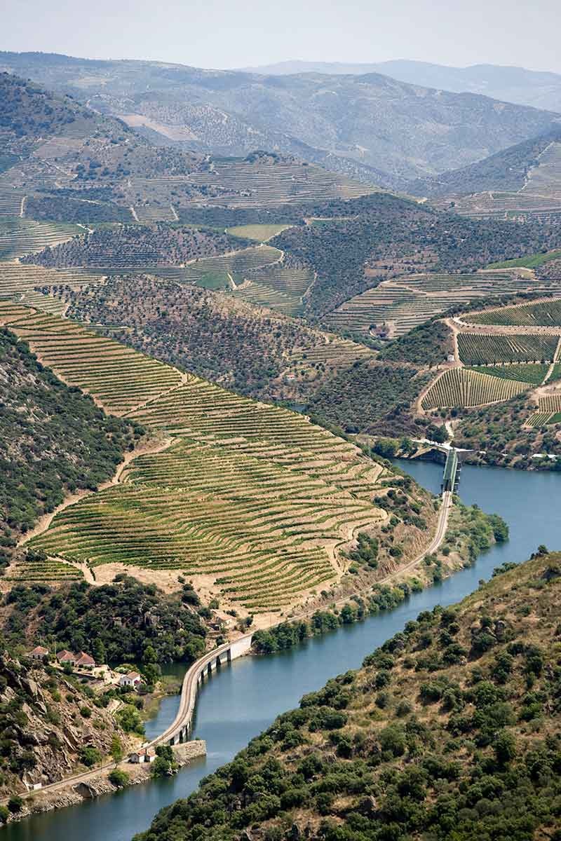
Located in the northeast of Portugal, in the Douro river basin, surrounded by mountains that give it particular mesological and climatic characteristics, the region covers a total area of around 250,000 ha and is divided into three naturally distinct sub-regions, not only due to climatic factors but also socio-economic factors.
These characteristics of the Douro region determine the economic use of natural resources and the activities carried out there.
In the past, vine cultivation was mainly concentrated in Alto Douro, and at that time, the term 'Alto Douro' was used to refer to the wine region that is now Baixo and Cima Corgo.
One of the original demarcation boundaries separated Alto Douro from Douro Superior, at the Cachão da Valeira area. This division was due to a geological accident (the granite monolith in the river that prevented navigation on the Douro River upstream of that obstacle). The difference between the two zones was evident, with vine cultivation being more prominent in Alto Douro.
Later, with the removal of the granite block during the reign of Queen Maria, vine cultivation spread eastwards, although it continued to be less important in the Upper Douro than in the Upper Douro.
With the administrative reform of 1936, the Alto Douro region itself came to be called Baixo Corgo and Alto Corgo, with this subdivision also serving to differentiate the wines produced in one or the other sub-region.
The vineyard area is most important in Baixo Corgo, where it occupies around 29% of the area of this sub-region, which extends from Barqueiros on the north bank and Barrô on the south bank to the confluence of the Corgo and Ribeiro de Temilobos rivers with the Douro.
Cima Corgo extends upstream to Cachão da Valeira, and the area cultivated with vineyards is less important. Douro Superior continues until the border with Spain.
Text and image taken from the Institute of Douro and Porto Wines.